Walking “The Great Waterfall Road” and exploring Tsutayacho Forest in Aomori, Japan
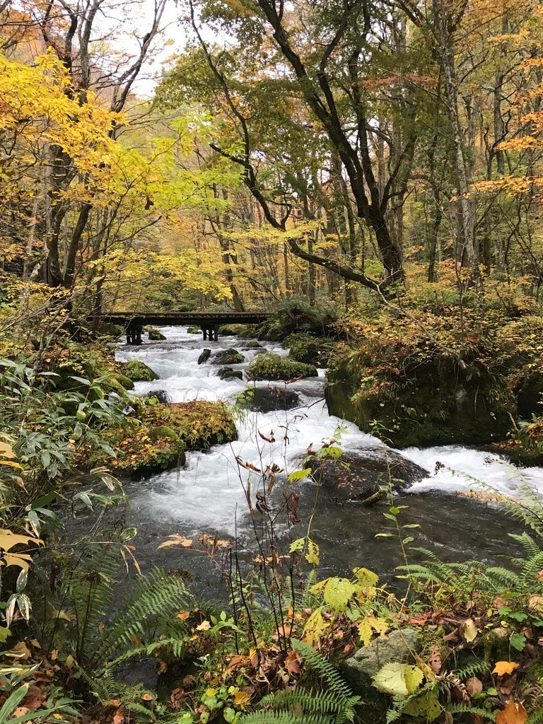
Hidden away in southern Aomori Prefecture is the wonderful Oirase Gorge. I had wanted to visit since I read about it years ago, and I finally got my chance last fall.
The gorge is famed for its many waterfalls, which I love, so I was looking forward to this trip. It far exceeded my expectations. The natural beauty was breathtaking.
Koyo, colored autumn leaves, canopied the clear, clean cascades of the Oirase River. The smell of the earth, the trees, the moss, and the sound of birdsong and rushing water enveloped me. It was the ultimate in forest bathing.
Walking in Oirase Gorge
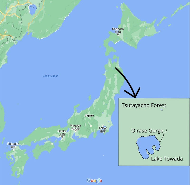
As I was staying by Lake Towada, I drove about 10 minutes from my inn in Yasumiya, on the lake’s south shore, to Nenokuchi on the eastern side, where the Oirase river begins. The parking lots were empty just after 7:00 AM on a Monday in late October.
It was cold and a little rainy, but that didn’t dampen my spirits.
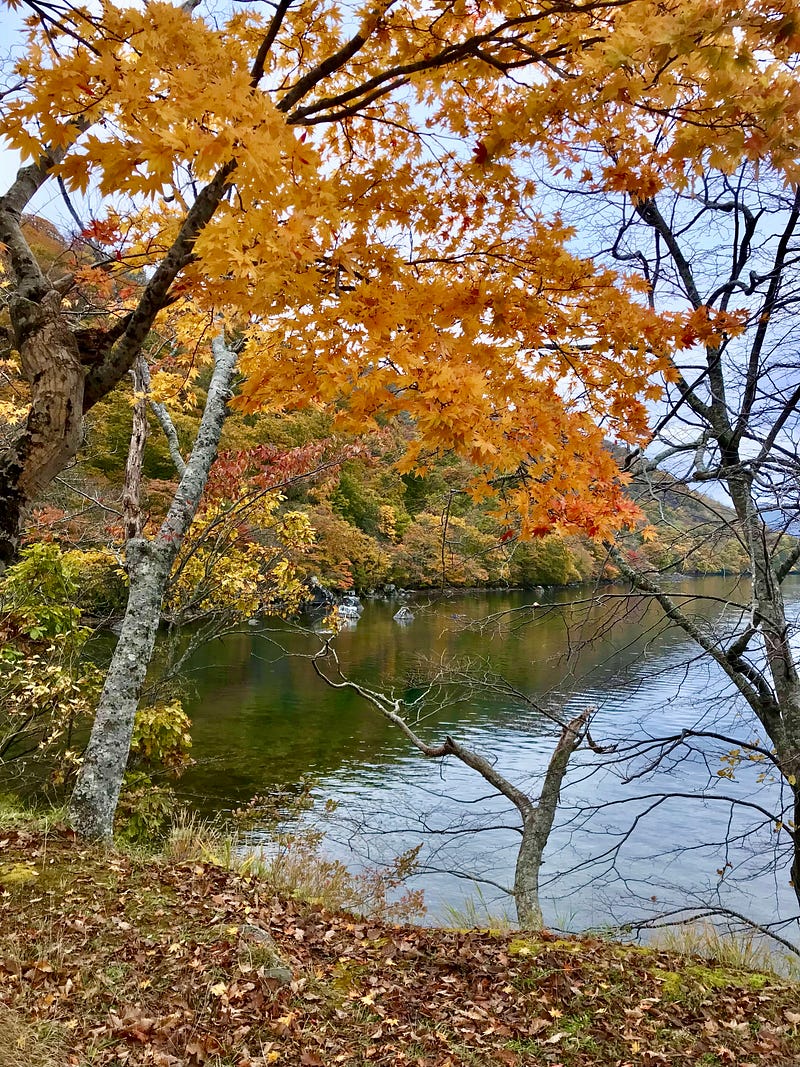
I snapped a photo of Lake Towada in its autumn glory, and then made my way to the start of the Oirase Gorge trail.
The trail is 14 kilometers long, following the Oirase River to the Towada Bridge in Yakeyama. Visitors are encouraged to stick to the trail to protect the natural environment. I was glad people had done that, as the more than 200 different varieties of moss covering rocks and trees gave a fairytale feel to the forest.
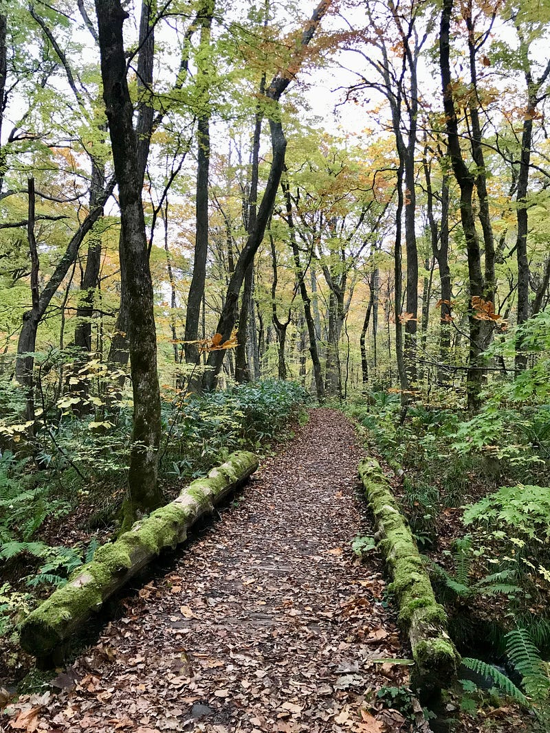
I had read that the most spectacular waterfalls were to be found within the first nine kilometers, so hiking those nine was my plan. Although there is a narrow road that also follows the gorge up the river, thankfully, it was mostly out of sight and there were few cars.
Soon, I met a photographer who had parked his tiny truck by the road and set up his equipment to capture a rushing cascade backed by glorious fall colors.
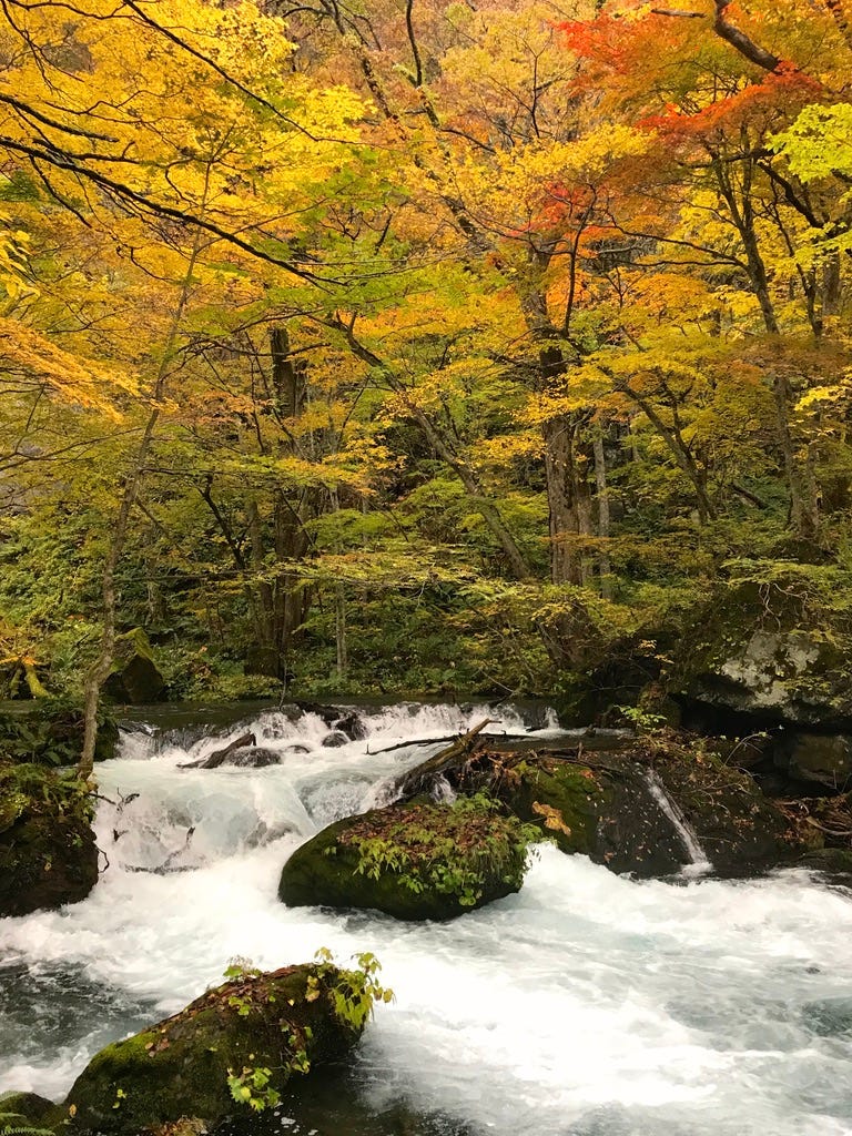
I joined him to bask in the beauty.
As I continued along the path, some movement across the stream caught my eye. I stopped to watch an adorable little bird hop along the side of the river, then dive, swim underwater, and pop back up onto a rock. I had never seen such a bird before. I later found out that it was a Brown Dipper, called in Japanese kawagarasu, “river crow.” I feel lucky to have seen it.
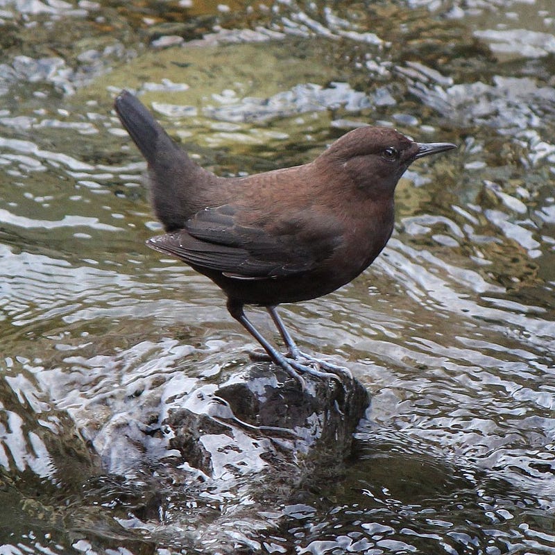
After walking for a couple of hours and enjoying the stream, the forest, and the many cascades and falls along the way, I arrived at Kumoi Falls, 雲井滝, “well of clouds.” This waterfall got its name from the spray that splashes up like clouds as it falls and bends along its 20-meter drop.
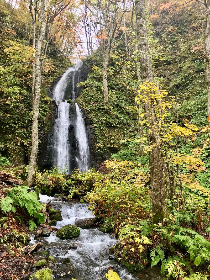
As you can see by the photos, not only moss, but many varieties of ferns flourish on the forest floor.
Before long, the river grew loud and violent as it tumbled and crashed around the Kujyūku-Shima, 九十九島, 99 Islands. So powerful is this section of the river that it was named after Ashura, 阿修羅, a fierce guardian Buddhist deity — the Ahsura Rapids.
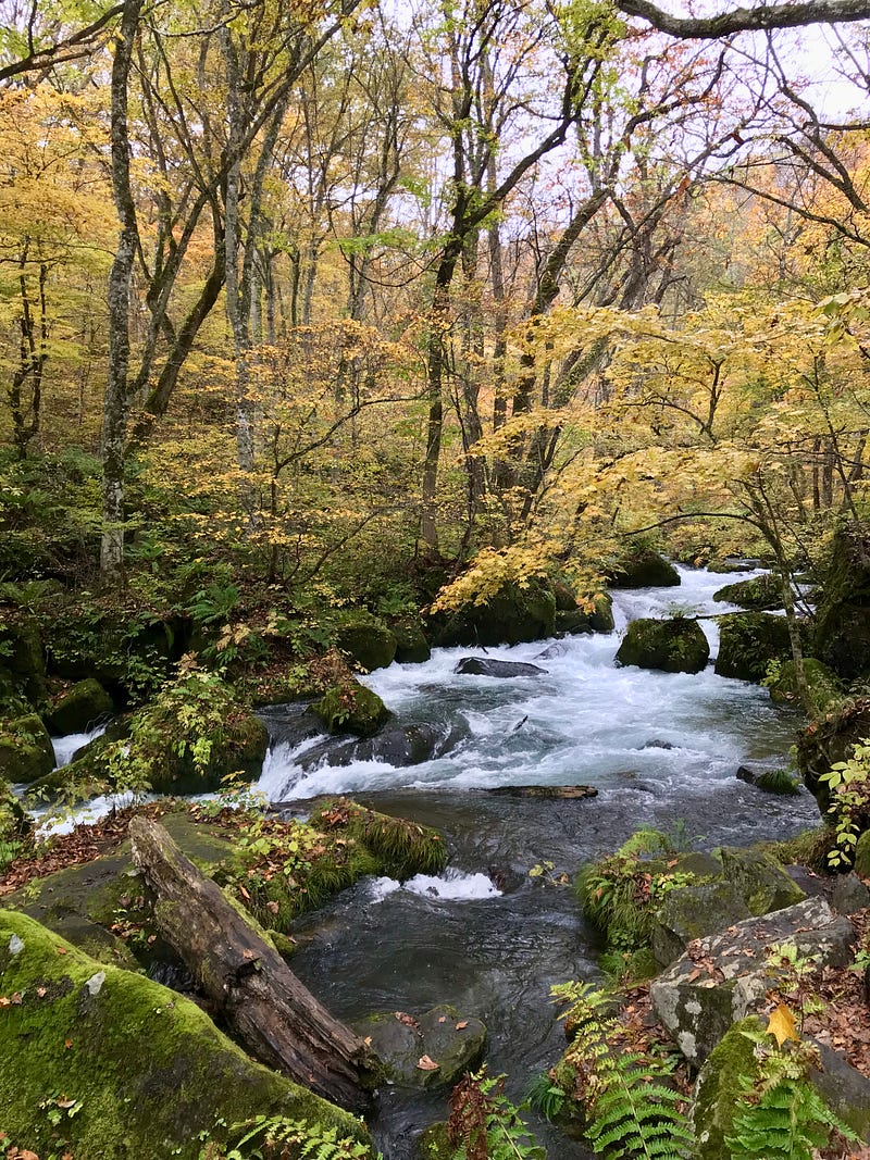
There were waterfalls large and small along the way. I particularly liked a delicate stream that fell in several tiers, called Chisuji Falls, 千筋の滝. Several people were taking photos of it, standing in the lightly falling rain.
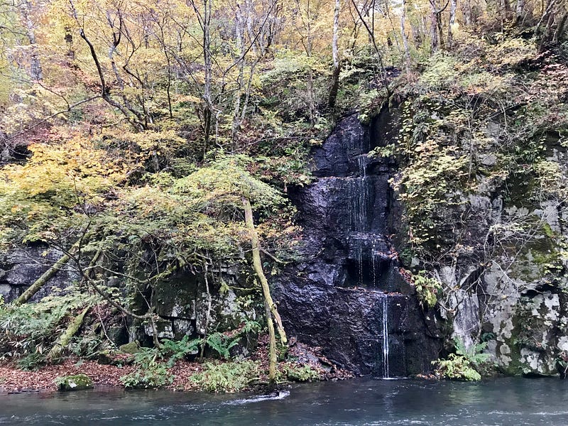
After a full morning of exploring, I reached my destination of Makodoiwa Rock, beside which is a bus stop. Having checked the schedule ahead of time, I knew when to catch the very few buses that plied that route.
I was soon back at Lake Towada after an unforgettable walk along the Bakufu-Kaido, 瀑布街道, “The Great Waterfall Road.”
The next stop was Tsutayacho no Mori, Tsutayacho Forest, a 30-minute drive to the north.
Tsutayacho Forest
Visiting the Tsutanuma Pond area was not part of my original plan, but when I saw it on the map, I wanted to check it out. I am so glad I did.
The area is a peaceful haven of trees and foliage reflected in still, clear ponds. A 2.6 km hiking trail leads from the parking lot around six small marshy ponds, the largest of which is Tsutanuma with a 1 km circumference.

I walked alone through the quiet forest, only the sounds of birdsong and the rustling of leaves to keep me company. Occasionally, a cute little bird would pop out of the underbrush onto the path ahead.
After about 20 minutes, I came upon the peaceful Suganuma Pond. I took a moment to sit in a small covered rest area to soak in the solitude.

I followed the path uphill and, after another 20 minutes, reached Naganuma Pond. I felt like I had stepped into a postcard, so picturesque was the setting.
Naganuma means “long pond or marsh.” The shallow pond changes its shape depending on the amount of rainfall. It was relatively small when I visited, but no less for beauty.

As I saw in the Oirase Gorge, the Tsutayacho forest floor was covered with moss and ferns, along with sasa bamboo and other grasses. The cool, crisp autumn air was filled with smell of the fresh earth, the fragrance of the trees, and the gentle sound of the wind in the leaves.
Yet another 20 minutes of leisurely walking and I went around a bend to behold Kagaminuma, Mirror Pond. So named because its clear water reflects the beautiful beech trees and foliage that surround it.

Then it was a downhill walk to Tsutanuma pond where I met other people who had skipped the longer walk, only wanting to visit this largest pond.
The trail took me past a shrine, an onsen (hot springs) hotel, and back to my car.

I settled in for the 90-minute drive to Hachinohe City. There, I would visit the beginning of the Michinoku Trail before catching the bullet train to Hiraizumi, the former fabulously wealthy capital of northern Japan, now a UNESCO World Heritage Site.
If you have questions about Japan or suggestions for articles, please add them in the comments. For more photos and information on Japan, follow me on instagram at: https://www.instagram.com/more_than_tokyo/


